All modern construction projects have as their main goal the smooth and immediate completion, through the effective implementation of all tasks. To make this possible, projects are segmented into various stages of construction, following specific organizational structures and proper management.
Surveying works are applied from the first stages of a project, since a necessary condition of any construction process is the recognition of the existing situation, as a background for the implementation of each study, as well as the identification of all stages in a common reference system. Topographical support works are also required during the construction, both for the progress of the works and for the control of the progress and the correct application of each study.
Our office has the ability to provide surveying support services for any project, whether a permanent installation of surveying crews is required within the construction site, or an occasional one. All our workshops consist of topographical engineers, with knowledge of the application object, making use of all the state-of-the-art technological means at our disposal (topographical instruments for field measurements and data processing software), always observing and with utmost care to all hygiene and safety rules.
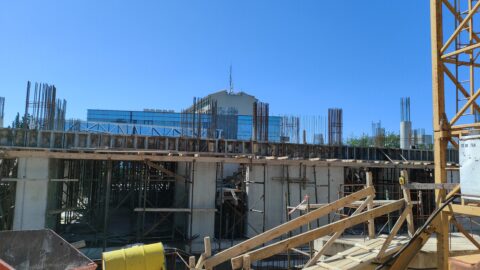
Construction site topographic support includes a wide range of tasks, following methods of pre-study, application, solution and extraction of the final information. This broad scope of work includes:
Establishment of control network
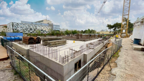
In every infrastructure project, the primary task for the smooth flow and development of the works is the establishment of a horizontal and vertical control network, with the aim of creating a reference system (local network or EGSA 87). It is the set of trigonometric points or points of known coordinates, placed in the construction site area, but also in the wider area, based on which all field work is carried out.
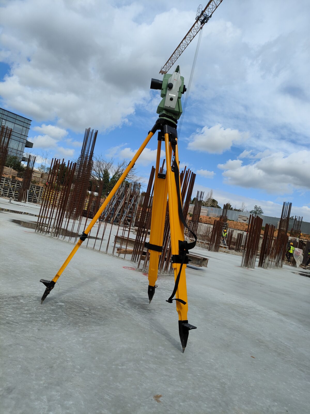
Space compensations
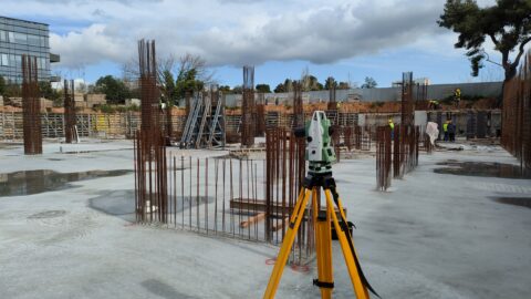
A very critical stage in any project is the determination of elevations and elevation differences of points, relative to a reference level. The topographic tools that help us to apply spatial weighting methods are the surveyors. Our high-precision digital surveyors help us perform surveying procedures with the least possible error.
Imprints
Imprinting is a process used throughout construction that aims to digitally render the existing condition. It is a process used:
- Initially for the drawing up of the topographical diagram and the issuance of the building permit
- To depict the current or initial state of the project
- During construction with the aim of monitoring the work and drawing up plans as–built
- For volume measurements of excavations and dimensioning of constructions
In cases where the specificity of a building or facility requires mapping specifications that are either time-consuming or cannot be performed with conventional methods, 3D mapping and modeling procedures are used, with the method of Laser Scanning or aerial unmanned aerial vehicles (UAV).
Engravings
With the process of engraving, we implement on the ground the points that define the area of a construction or an excavation. Their horizontal position in real space is determined, as well as the elevation information that is necessary for the construction. The equipment and method used varies according to the uncertainty margins and required accuracy, according to the standards of the study. The engraving process is applied:
- In excavations (excavation limits and depth)
- To determine the position of structural elements during the foundation and construction of building facilities
- For the installation of metal structures and mechanical equipment
- To indicate and apply reference axes
- To determine altitudes and levels
All work is carried out with the use of the appropriate equipment, which includes Geodetic Stations (Total Stations), Satellite Receivers (GPS) and high-precision Land Rovers. 3D Laser Scanners and Unmanned Aircraft (Drones and UAVs) can be used in special applications