An extension of drafting a topographical diagram is the topographical study of an area.
In the cases of topographical studies, the whole of an area is examined, for the sake of some public or private body, with the aim of mass changes and improvements of the study area.

Our company's prerequisite is the use of modern technological means both in field work and in processing and design, always respecting the technical specifications, as defined by the customer and state regulations.
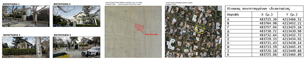
The method of surveying an area may vary, depending on the size of the area or the required accuracies and specifications, and may be carried out either by ground or aerial means. Our office provides services of topographic surveying and compilation of topographic studies in any way, since it has the necessary equipment and the appropriate processing software. Our experience in topography studies and our technological means are the key to success for the preparation of studies of any requirements.
Defining institutional lines
Drainage and Construction line
In the context of a topographic study, it is usually necessary to apply special linear entities that define, separate and shape the structure and location of specific geographic data. The zoning plan is the basis on which cities and settlements are built and includes the detailed depiction on a map of the building blocks, the boundary lines which separate the areas of the building block from the common areas and the building lines which determine the boundary of the building block in which construction is permitted. Usually the Flow line is shown in green and the Construction line in red.

Stream boundary line
In areas where a stream passes through, it is necessary to define the boundary lines of the stream as the non-demarcation of a watercourse of permanent or non-permanent flow creates a problem when trying to issue a building permit. The demarcation, either as an administrative act or the temporary demarcation of a stream, is a process which largely consists of a detailed topographical survey of the bank of the stream, i.e. the slopes on either side of which the flow of the bed is created, as well as the technical constructions near or within it stream. When drawing up a topographical study or a topographical diagram, it is very important to correctly apply the already delineated streams as well as to recapture the existing state of the watercourse in order to render them correctly and accurately in the plan.
Defining of seashore and beach
The definition and implementation of these institutional lines is a matter of essential importance, as it concerns issues not only of urban planning but also of environmental concern.
The concepts of seashore and beach are the boundary lines that define:
- The longitudinal part of the land that is wetted by the sea, in the biggest ascents of its waves (seashore )
- The longitudinal section of land located at a specified distance and parallel to the shore (beach), serving access to and from the sea
The drawing up of a topographical diagram for the definition of the coastline and beach is a complete topographical study, providing horizontal and elevational information, following the standards and regulations set by the competent services.
Acts of implementation and reflection
A basic tool for the regulation and rational organization of the urban and peri-urban space is the urban planning and the application of the appropriate zoning. Part of this planning is also the Implementation Act or as it is now called with Law 4739/2020, Streamlining Implementation Plans.
Essentially, it is an urban planning study, by which the parts of the properties are determined from which they are removed and their conversion into a contribution to land or money. It is a process in which the properties are arranged in terms of area, shape and dimensions, in order to obtain even and buildable plots.
Therefore, even plots that were not even in terms of their area, are arranged by their attraction, that is, their joining to neighboring plots or in some cases new even plots are created by the joining of two or more non-even parts.
The implementation act usually concerns the urban planning study of an entire area. There are cases where, due to errors in the initial study, a corrective action is recommended for individual cases. In this case, the plan to be drawn up is accompanied by corrected tables of the implementation act and actuarial tables (if deemed necessary), as well as from other supporting documents such as property declarations, technical report, etc.
All work is carried out with the use of the appropriate equipment, which includes Geodetic Stations (Total Stations), Satellite Receivers (GPS) and high-precision Land Rovers. 3D Laser Scanners and Unmanned Aircraft (Drones and UAVs) can be used in special applications