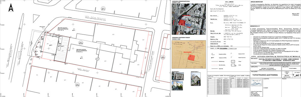
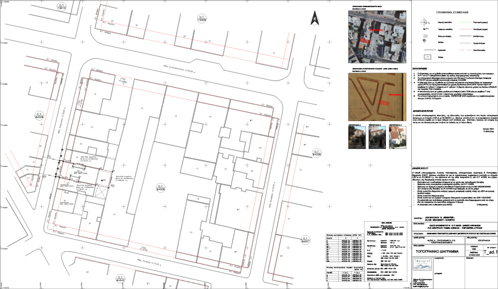
The exact determination of the location of a property is now imperative since in order to carry out any notarial or cadastral process, a modern topographical diagram is needed, dependent on the Greek Geodetic Reference System of 87.
A topographical diagram is the application of procedures and methods to determine the location, shape and characteristics of an area as defined by the science of Geodesy and Topography. It is a process that requires deep knowledge of the scientific processes and the legislative framework that governs the respective area of interest.
The specifications that a topographical diagram must meet are directly related to the use for which it is intended, such as for granting to Public or private bodies, notaries, lawyers, real estate agencies, etc.
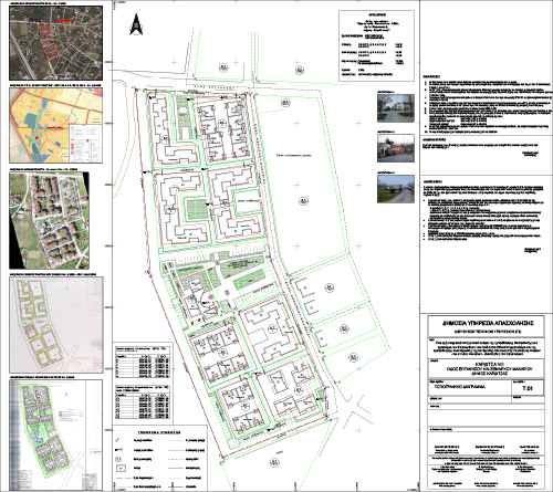
In order to make it possible to draw up a topographical diagram, the process is divided into the following three stages:
- Field work: establishment of polygon points/stops, establishment and measurement of route network, surveying of the area
- Office work: careful analysis, resolution and processing of data for the final design
- Research: visit to public services. A particularly important stage of the research, since it collects data such as the building conditions of the area, the legislation in force at the specific time in the area, as well as various other urban planning data
Preparation of any legal deed / notarial deed (sales, transfers, etc.)
In order to make it possible to draw up any notarial deed, it is required (from the client to the notary) to present:
- A recent topographical diagram, included in Greek Geodetic Reference System of 87 and updated in terms of building conditions and applicable legislation
- The proof of digital submission of the topographic map to the National Land Registry (a process carried out by the engineer after the completion of the topographic map)
- An engineer's certificate of non-arbitrary or structural defects
Declaration to the National Land Registry
It is a fact that the topographical diagram is not a necessary document for the declaration of a property in the Greek land registry. However, it is the document that precisely indicates the boundaries, always taking into account the property titles, with the result that there will be no need to make any objection or corrective action later on.
In the event that a field-property has undergone a schematic change following some amalgamation, owning by use or other act, it is necessary to file in the land register a Topographic Diagram of Geometric Changes, which will depict the boundaries of the property before and after the act, so that the change to be registered in a Code Number of the Greek Land Registry.
Designation acts (forest department)
In many regions of Greece, the process of sanctioning forest maps has not been completed, as a result of which there are areas that do not have an official designation or are incorrectly designated.
In this case and following a relevant request, a topographic map is submitted to the competent Forestry Office or Forestry Service, adapted to the requirements of the service, such as for example being attached to the topographic map of the Army Geographical Service, on a scale of 1 :5000, showing the outline of the property.
Issuance of a building permit
Each Building and Urban Planning Service, in order to proceed with the issuance of a building permit, requests a topographical diagram detailing the area, with the specifications defined by the Ministry of Environment, Energy and Climate Change
This topographical map is the basis for the civil engineer or architect, since it contains all the necessary information that will help him to draw up his study and complete his own plans.
Expropriations
There are several cases in which government agencies, such as Municipalities, use procedures in which they remove portions of land from private properties, for the purpose of public benefit. This process is called expropriation.
Expropriation is divided into forced and spatial planning one, without any substantial difference between them, since both cases lead to the same result.
Their real difference focuses on the reason they are implemented.
Forced expropriation is applied in cases where public spaces are to be built, such as e.g. schools, churches etc., while the spatial planning one is applied in cases of urban planning.
It is important for a topographical diagram that the boundaries of an expropriated zone are marked in detail and care, because it makes it easier to understand the part to be removed, to draw the boundaries on the ground and to calculate the corresponding compensations.
An extension of drafting a topographical diagram is the topographical study of an area.